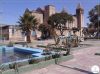
1 - Characterization of the Province of Huíla
Location
Huíla Province is located in the Southwest of the Republic of Angola, having a rectangular shape and has the following confrontations and limits:
• North: The provinces of Benguela and Huambo;
• South: Cunene Province;
• East: The provinces of Bié and Cuando Cubango;
• West: Namibe Province and Benguela Province;
Climate
The climate of the Province varies between the tropical of altitude, in the North Center and in the Plateau of the Humpata is semi-arid in the areas of lower altitude. There are two stations throughout the province:
• Rainy season: from October to April, characterized by average temperatures between 19º and 21º C and average rainfall between 600 and 1200 mm;
• Dry season (Cacimbo), in the remaining months of the year, with average temperatures oscillating between 15.5 and 19º C, accentuated daily thermal amplitudes, absence of rainfall and consequently very low relative humidity.
Territorial extension The Territory is part of the vast set of plateau surfaces in the Angolan interior with altitudes between 1000 and 2300 meters.
The lower altitudes correspond to transition levels, both to the West and Northwest and to the South and Southwest, with the intermediate altitudes being 1400-1800 meters, corresponding to the southern part of the Central Plateau.
The highest elevation surfaces, 1900-2300 meters, are part of the Humpata Plateau, especially the Bimbe, which is the highest level of the Southwest Angolan.
The Province has an area of approximately 79,023 km² and an estimated population of approximately 3,334,456 million inhabitants.
DISTRIBUTION OF THE PROVINCE'S POPULATION
Municipality Area km² Total inhabitants Population density
Lubango 3.140 1.414.115 450
Humpata 1.261 100.819 80
Quilengues 4.464 123.005 28
Quipungo 7.633 221.502 29
Caconda 4.715 176.140 37
Matala 9.065 222.880 25
Caluquembe 3.075 239.036 78
Gambos 8.150 151.375 19
Kuvango 9.680 93.272 10
Jamba 11.110 126.799 11
Chicomba 4.203 110.291 26
Chipindo 3.898 71.000 18
Chibia 5.180 206.506 40
Cacula 3.449 77.716 23
TOTAL 79.023 3.334.456 42
ADMINISTRATIVE ORGANIZATION
Administratively, the Province has 14 Municipalities:
Lubango, Quilengues, Humpata, Quipungo, Caconda, Matala, Caluquembe, Gambos, Cuvango, Jamba, Chicomba, Chipindo, Chibia and Cacula and has 39 Communes.
Ethnologically, the population of the Huíla Province is diverse, since it consists mainly of 4 ethnolinguistic groups, namely: Nyaneca-Nkhumbi, Ovimbundu, Ngangela and Herero.
In the Huíla Province, the Nyaneca-Humbi ethnolinguistic group includes the Ovamwila from the Mwila region, the Ovanyaneca from the Nyaneka region, the Ovangambwe from the Ngambwe region, the Ovahanda from the Handa region, the Ovahumbi from the Humbi region, the Ovatchipungu from the Tchipungu region, the Ovatchilungu. from the Tchilengue region and the ovankhumbi from the Nkhumbi region.
Its territory covers the Municipalities of Lubango, Humpata, Chibia, Gambos, Quipungo, Cacula, Quilengues, Matala and the south of the Municipalities of Kalukembe and Chicomba, as well as the west of the Municipality of Jamba.
The Ovimbundu inhabit the Municipalities of Caconda and, the north of the Municipalities of Caluquembe, Chicomba and Chipindo. The Nganguela inhabit the Municipalities of Jamba, Kuvango and partially the Municipality of Chipindo. The Herero inhabit the Municipality of Gambos.
THE CITY OF LUBANGO
In the city of Lubango, there was a reconfiguration regarding its ethnic composition. Once inhabited mainly by the ovanyaneca-nkumbi, today due to the war conflict that devastated vast areas of our country, ethnic groups immigrated from all parts of Angola affected by this scourge.
Thus, the ovimbundu, the nganguela, the tchokwe, the bakongo, the fiote, the quimbundu, the ochiwambo, etc. became part of the ethnic mosaic of the capital city of the Province of Huíla, which became a cosmopolitan city, as happened with the city of Luanda.
 English
 Português